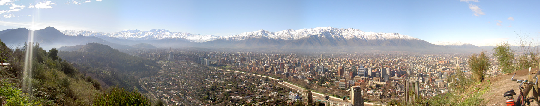
Every major intersection in Santiago’s centre is a right angle, which sounds like a minimum requirement for a city but is, in fact, an achievement. The city was laid out in its current form in the eighteenth century on a plan that reflects both Spanish colonial urban planning principles and the particular geography of the site, a flat valley floor between the Andes and the coastal range where a grid is both logical and satisfying. Walking it is easy in a way that many South American cities are not. You know where you are relative to where you want to be, and the knowledge holds as you move, which is more unusual than it should be.
Santiago is the commercial and political centre of a country that runs four thousand kilometres from north to south along the Pacific coast, narrowing in places to fewer than two hundred kilometres between the ocean and the Argentine border, a geography that makes Chile one of the most elongated countries on earth and gives it an extraordinary range of climatic and ecological zones within a single national territory. The Atacama Desert in the north, one of the driest places on earth, the Patagonian ice fields in the south, the vineyards of the central valley, the Mediterranean climate of the Santiago basin: all of this is Chile, a country whose political history has been as dramatic as its geography, and whose capital carries the evidence of that history in ways that become visible once you know to look.


Share